矢量图形
OpenLayers 中的矢量图形,Feature(要素)和 Geometry(几何)类构成了矢量图形系统的基础
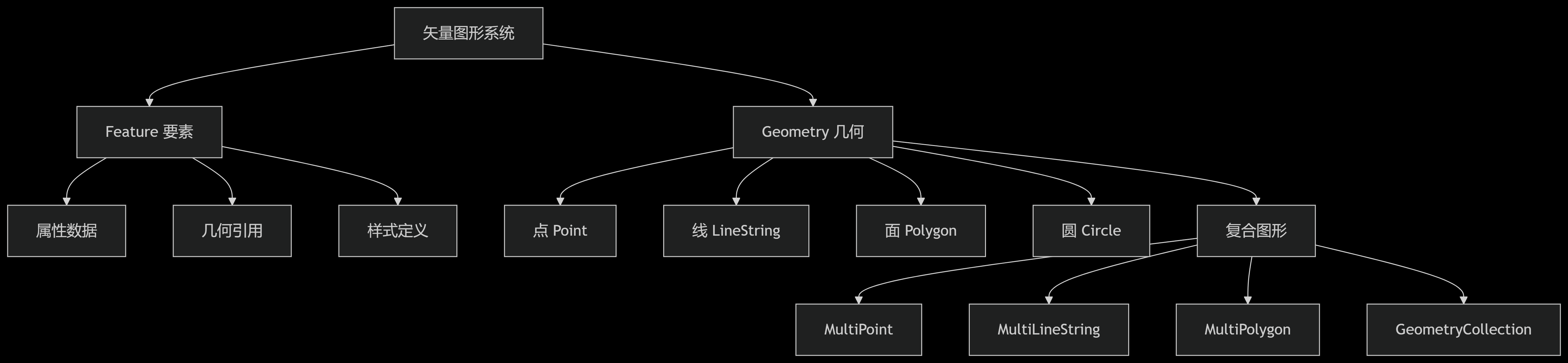
Geometry 类详解
Geometry 类表示地理空间中的形状,是所有几何图形的基类。
类型一览
| 几何类型 | 描述 | 创建示例 |
|---|---|---|
| Point | 单点位置 | new Point([x, y]) |
| LineString | 线(有序点序列) | new LineString([[x1,y1], [x2,y2]]) |
| Polygon | 多边形(外环+内环) | new Polygon([[[x1,y1], [x2,y2], ...]]) |
| Circle | 圆形 | new Circle(center, radius) |
| MultiPoint | 多点集合 | new MultiPoint([[x1,y1], [x2,y2]]) |
| MultiLineString | 多线集合 | new MultiLineString([[...], [...]]) |
| MultiPolygon | 多面集合 | new MultiPolygon([[...], [...]]) |
| GeometryCollection | 混合几何集合 | new GeometryCollection([point, line]) |
公共方法
所有几何类型都继承自 ol/geom/Geometry 基类,具有以下公共方法
| 方法 | 描述 | 参数 |
|---|---|---|
| clone() | 创建几何的深拷贝 | - |
| getExtent() | 获取空间范围 | extent(可选) |
| getType() | 获取几何类型 | - |
| transform(source, destination) | 转换坐标系 | sourceProj, destProj |
| applyTransform(transformFn) | 应用自定义坐标变换 | transformFn |
| simplify(tolerance) | 简化几何 | tolerance |
| rotate(angle, anchor) | 旋转几何 | angle(弧度), anchor(中心点) |
| scale(factorX, factorY, anchor) | 缩放几何 | factorX, factorY, anchor |
| translate(deltaX, deltaY) | 平移几何 | deltaX, deltaY |
| intersectsCoordinate(coordinate) | 判断坐标是否在几何内 | [x, y] |
| intersectsExtent(extent) | 判断是否与范围相交 | [minX, minY, maxX, maxY] |
| getCoordinates() | 获取坐标 | - |
| setCoordinates(coordinates) | 设置坐标 | 坐标数组 |
点(Point)
点几何表示地球上的一个单一位置。
js
import Point from "ol/geom/Point";

const point = new Point([116.4074, 39.9042]);
point.getCoordinates(); // [116.4074, 39.9042]

point.transform("EPSG:4326", "EPSG:3857"); // [12245410.74511129, 3844357.763493687]
线(LineString)
线几何表示由有序点序列组成的路径。
特有方法:
- getLength():返回线要素在投影平面上的长度
- getCoordinateAt(fraction):根据参数 fraction(取值范围 0 到 1)返回线要素上的坐标
- forEachSegment(callback):遍历线要素的每个线段,对每个线段执行回调函数
- callback:对每个线段执行的回调函数,参数为 (start, end),start 和 end 分别为线段的起始点和结束点坐标
js
import LineString from "ol/geom/LineString";

const line = new LineString([
  [0, 0],
  [10, 10],
]);
line.getLength(); // 14.142135623730951
line.getCoordinateAt(0.5); // [5, 5]
面(Polygon)
面几何表示由有序点序列组成的闭合区域。
特有方法:
- getArea():返回面要素在投影平面上的面积
- getInteriorPoint():返回面要素内部的一个点
js
import Polygon from "ol/geom/Polygon";

const polygon = new Polygon([
  [
    [0, 0],
    [10, 0],
    [10, 10],
    [0, 10],
    [0, 0],
  ],
]);
polygon.getArea(); // 100
polygon.getInteriorPoint().getCoordinates(); // [5, 5, 10]
圆(Circle)
圆形几何,Circle 类表示一个圆形区域。
new Circle(center, radius)
- center:圆的中心点坐标,格式为 [x, y]
- radius:圆的半径,单位与地图投影单位相同
特有方法:
- getRadius():返回圆要素的半径
- getCenter():返回圆要素的中心点
- setRadius(radius):设置圆要素的半径
- setCenter(center):设置圆要素的中心点
- setCenterAndRadius(center, radius):同时设置中心点和半径
js
import Circle from "ol/geom/Circle";

const circle = new Circle([0, 0], 5);

circle.getRadius();

circle.getCenter();

circle.setRadius(10);

circle.setCenter([1, 1]);

circle.setCenterAndRadius([2, 2], 15);
多点(MultiPoint)
MultiPoint 类表示多个点的集合。
特有方法:
- getPoints():返回多点要素的点数组
- getPoint(index):返回指定索引的点
- appendPoint(point):添加一个点到多点要素中
js
import MultiPoint from "ol/geom/MultiPoint";

const multiPoint = new MultiPoint([
  [0, 0],
  [10, 10],
]);

multiPoint.getPoints(); // [Point, Point]

multiPoint.getPoint(0); // Point

multiPoint.appendPoint(new Point([20, 20]));
多线(MultiLineString)
MultiLineString 类表示多个线的集合。
特有方法:
- getLineStrings():返回多线要素的线数组
- getLineString(index):返回指定索引的线
- appendLineString(lineString):添加一条线到多线要素中
- getLength():返回多线要素的总长度
js
import MultiLineString from "ol/geom/MultiLineString";

const multiLine = new MultiLineString([
  [
    [0, 0],
    [10, 10],
  ],
  [
    [20, 20],
    [30, 30],
  ],
]);

multiLine.getLineStrings(); // [LineString, LineString]

multiLine.getLineString(0); // LineString

multiLine.appendLineString(
  new LineString([
    [40, 40],
    [50, 50],
  ])
);
多面(MultiPolygon)
MultiPolygon 类表示多个面的集合。
特有方法:
- getPolygons():返回多面要素的面数组
- getPolygon(index):返回指定索引的面
- appendPolygon(polygon):添加一个面到多面要素中
- getArea():返回多面要素的总面积
js
import MultiPolygon from "ol/geom/MultiPolygon";

const multiPoly = new MultiPolygon([
  [
    [
      [0, 0],
      [10, 0],
      [10, 10],
      [0, 10],
      [0, 0],
    ],
  ],
  [
    [
      [20, 20],
      [30, 20],
      [30, 30],
      [20, 30],
      [20, 20],
    ],
  ],
]);
multiPoly.getArea(); // 200
multiPoly.appendPolygon(
  new Polygon([
    [
      [5, 5],
      [15, 5],
      [15, 15],
      [5, 15],
      [5, 5],
    ],
  ])
);
集合(GeometryCollection)
GeometryCollection 类表示多个几何要素的集合。
特有方法:
- getGeometries():返回集合中的几何要素数组
- setGeometries(geometries):设置集合中的几何要素数组
- getExtent():返回集合中所有几何要素的范围
js
import GeometryCollection from "ol/geom/GeometryCollection";

const collection = new GeometryCollection([
  new Point([0, 0]),
  new LineString([
    [0, 0],
    [10, 10],
  ]),
]);
collection.getGeometries().length; // 2
Feature 类详解
在 OpenLayers 中,一个 Feature 对象就表示一个地理要素。
核心概念
- Feature = Geometry + Attributes + Style
- 每个 Feature 代表地图上的独立实体(如建筑物、道路)
- 通过 Vector Layer 渲染到地图
属性
- 直接传递一个 Geometry 对象,或者传入一个对象,存在
geometry键,Geometry 会和这个键相关联
js
// 示例1:直接传入一个 Geometry 对象
const feature = new Feature(new Point([116.4074, 39.9042]));

// 示例2:传入一个对象,存在 geometry 键,Geometry 会和这个键相关联
const feature = new Feature({
  geometry: new Point([0, 0]),
  name: "YGYong",
});
方法
getGeometry():获取要素的几何对象setGeometry(geometry):设置要素的几何对象get(key):获取要素的属性值set(key, value):设置要素的属性值getProperties():获取要素的所有属性setProperties(properties):设置要素的所有属性getGeometryName():获取要素的几何类型名称setGeometryName(name):设置要素的几何类型名称getKeys():获取要素的所有属性键getStyle():获取要素的样式setStyle(style):设置要素的样式getId():获取要素的唯一标识符setId(id):设置要素的唯一标识符,要素 ID 可以与 getFeatureById 方法一起使用
js
// 创建要素
const feature = new Feature({
  geometry: new Point([0, 0]),
  name: "YGYong",
});

// 获取name属性
const name = feature.get("name");
js
// 设置ID
feature.setId("feature_001");

// 获取ID
const featureId = feature.getId();

// 通过source获取ID
const featureById = source.getFeatureById("feature_001");
js
// 设置几何
feature.setGeometry(new Point([10, 20]));

// 获取几何
const geom = feature.getGeometry();
js
// 设置属性集合
feature.setProperties({
  name: "重要设施",
  type: "医院",
  capacity: 500,
  contact: {
    phone: "123-456-7890",
    email: "contact@example.com",
  },
});

// 获取属性集合
const properties = feature.getProperties();
js
// 设置固定样式
feature.setStyle(
  new Style({
    image: new CircleStyle({
      radius: 10,
      fill: new Fill({ color: "red" }),
    }),
  })
);

// 设置动态样式函数
feature.setStyle((feature, resolution) => {
  const size = resolution < 100 ? 10 : 5;
  return new Style({
    image: new CircleStyle({
      radius: size,
      fill: new Fill({ color: "blue" }),
    }),
  });
});